
For many who follow on Twitter, they know I’ve felt for days Lee and Charlotte County would potentially get impacts from Ian. The Euro model never shifted that far west, and history tells us southwest Florida tends to be a magnet for storms in the Gulf.
The uncertainty of the forecast has led to the NHC doing something they usually don’t do – adding watch and warning areas closer to a potential landfall than is typical.
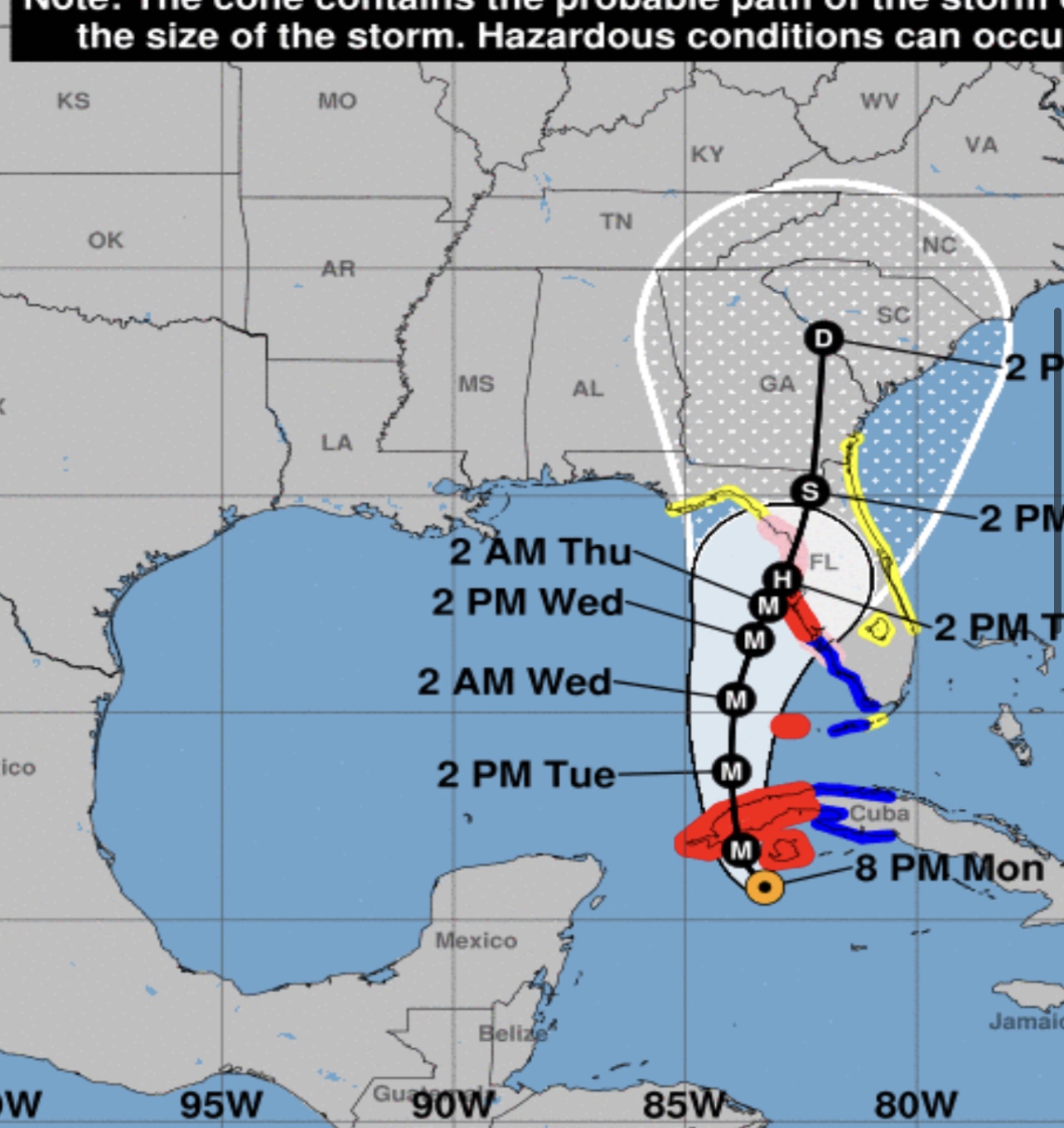
Historically, the NHC blankets any area that might get impacts with watches and warnings. They did it watches this time and upgraded them to warnings for the Tampa Bay and Sarasota/Bradenton areas as well as Dry Tortugas right on cue, when the clock was ticking toward impacts. But now they’ve been forced to add new areas.
Lee and Charlotte Counties were originally not in the Hurricane Warning area but have been wisely added at 5 am Tuesday. A Tropical Storm Warning on the east coast has been issued from Jupiter to the Volusia/Brevard line as it becomes more likely that Ian becomes a peninsula event.
Also of note. a Tropical Storm Watch was issued from Deerfield Beach to Jupiter, effectively bringing Palm Beach County, Florida’s third most populated county into play for some impacts. As we noted last night, West Palm Beach has over a 45% of TS force winds from Ian, so this is logical, but again a late add which is not ideal for local emergency planning purposes. A watch was also issued for interior sections of Broward and Miami-Dade.

Right now, the entire southern quarter of the peninsula is being hammered by outflow from Ian. The NHC has done the best they could with this storm, but its unpredictability which they noted from the get-go is creating challenges we don’t often see with Major Hurricanes in terms of forecast path and preparations.


