
Modeling has gotten better since 2004 when Hurricane Charley confounded forecasters, but with Ian taking a similar dead aim at the west coast of Florida, this is the time to review Charley.
Charley was supposed to first track through the Keys into SW Florida.

Then the forecast changed to bring it directly into the Tampa Bay area. Feeling (unwisely) that Orlando was safe, masses of people moved inland. BTW, Orlando is about the least safe place in a Hurricane outside immediate coastal areas, as the peninsula is so narrow that it gets hit from both directions being in the center of the state.

Then the storm made a weird detour at the last minute, hitting Port Charlotte directly and maintaining Hurricane status all the way through the peninsula including Orlando. The Tampa Bay Area got Tropical Storm force winds only.

Coastal residents need to evacuate in a storm, but my advice to others is always stay put unless you plan to leave the state. No place in Florida is safe from any approaching storm, owing to our unique geography. We can tell similar stories from Frances and Irma, storms that became statewide events.
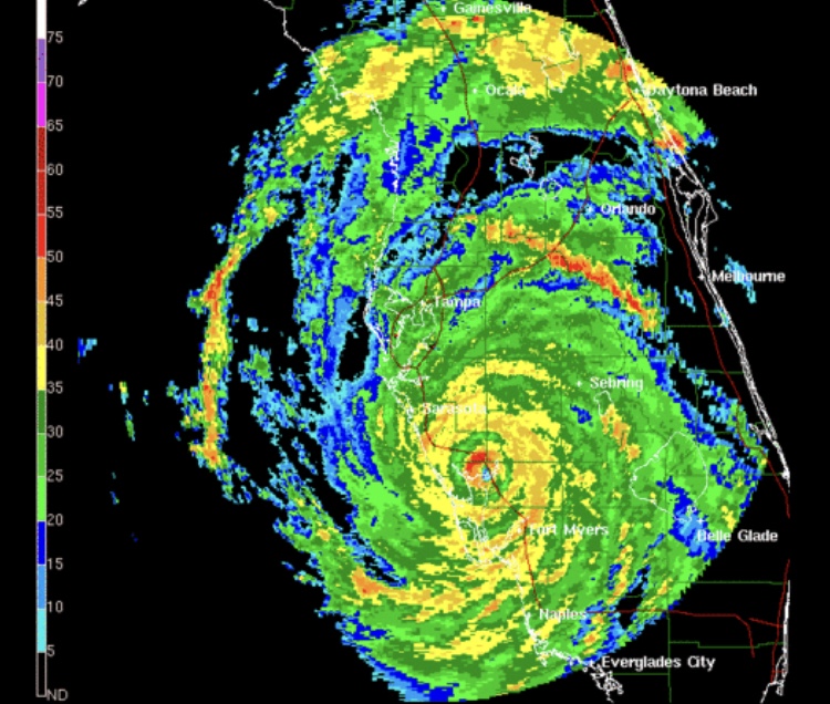


[…] As the state casts its eye on Ian and the constantly shifting models, one thing remains clear. The Tampa Bay Area which has not been directly hit by a Hurricane since 1921 (1968 if you count Citrus County) is going to get a real dose of what the rest of the state has suffered through. Every east coast region from Jacksonville south has experienced a direct hit from a Hurricane since 1964, from Daytona south since 2004. Every area of Southwest Florida has suffered multiple direct hits since 2004. Along the Panhandle and Big Bend outside of the 2006-2015 time period (when no Hurricanes hit the state), it feels like direct hits are a yearly occurrence. The Tampa Bay seemed the one place due to its unique geography that was safe in the state, and the closest call, Charley in 2004, veered south and hardly impacted the area. […]
LikeLike