
Breaking my Twitter sabbatical for #Idalia, though I plan to resume it after the storm clears Florida.
Some observations:
1- I’ve seen the modeling trend eastward over the last 18 hours. Pretty consistent eastward shift. The NHC has now adjusted its forecast track accordingly. This brings the Tampa Bay area into play.
2- The midlevel trough will almost certainly turn the storm BEFORE it reaches the Big Bend. That doesn’t rule out a Big Bend landfall but I am thinking it might be further south and east now, like Cedar Key or even Homosassa .
3- While some shearing looks likely as the system moves further north, the Gulf right now is like a sauna. This system will be a Hurricane at landfall. Probably just a Cat 1 but a Hurricane nonetheless. For areas along the Gulf Coast from St Marks southeast ward to St Petersburg I’d start preparing NOW.
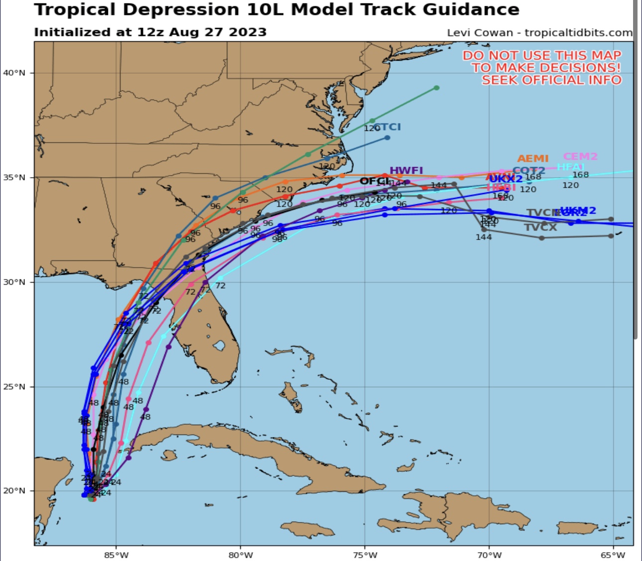
Latest model runs above. Waiting on the GFS and will pull the Euro at some point. Thanks to TropicalTidbits.com for this graphic.


