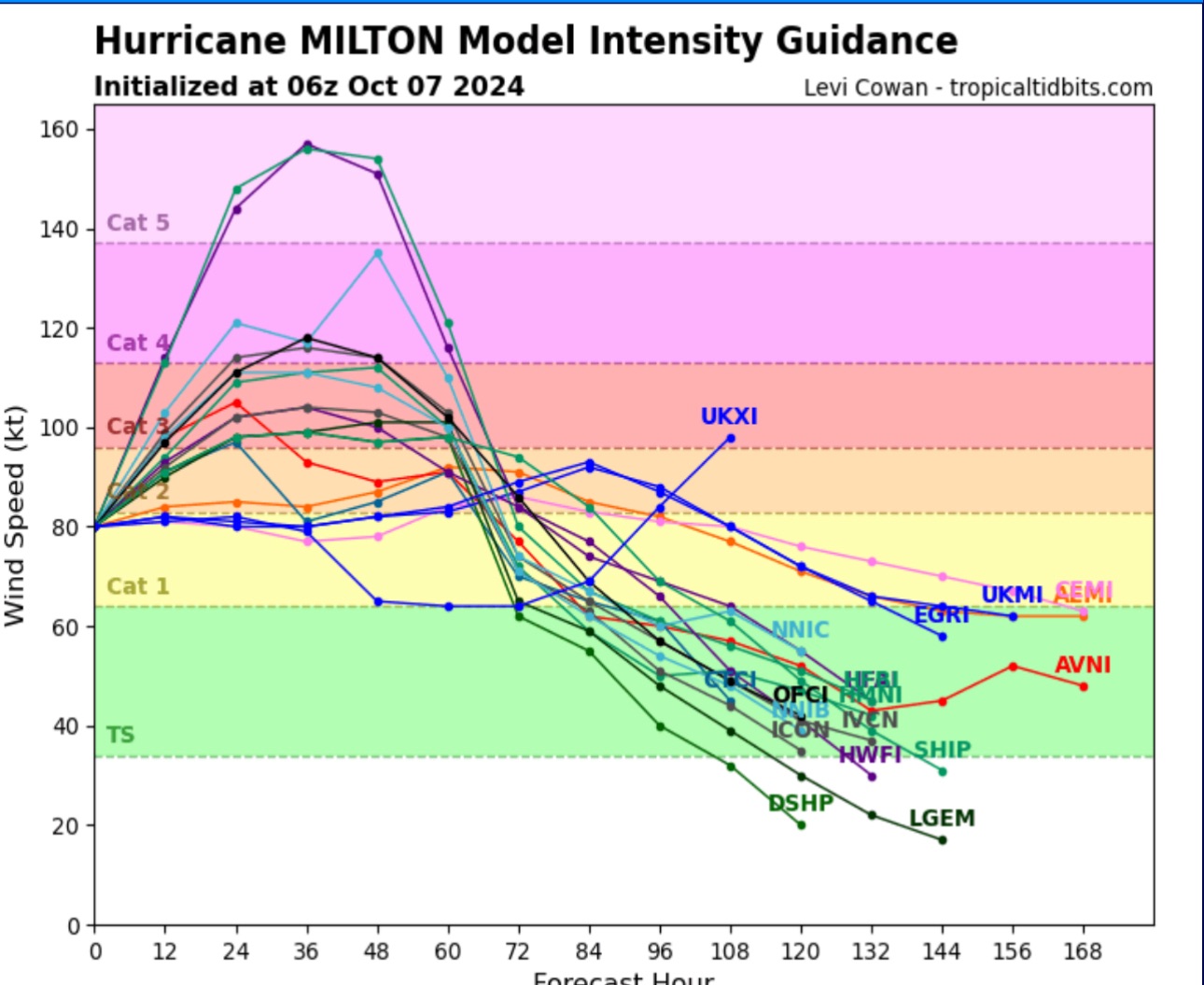
Milton is now a major Hurricane, a Category 3 per the 8 am NHC update.

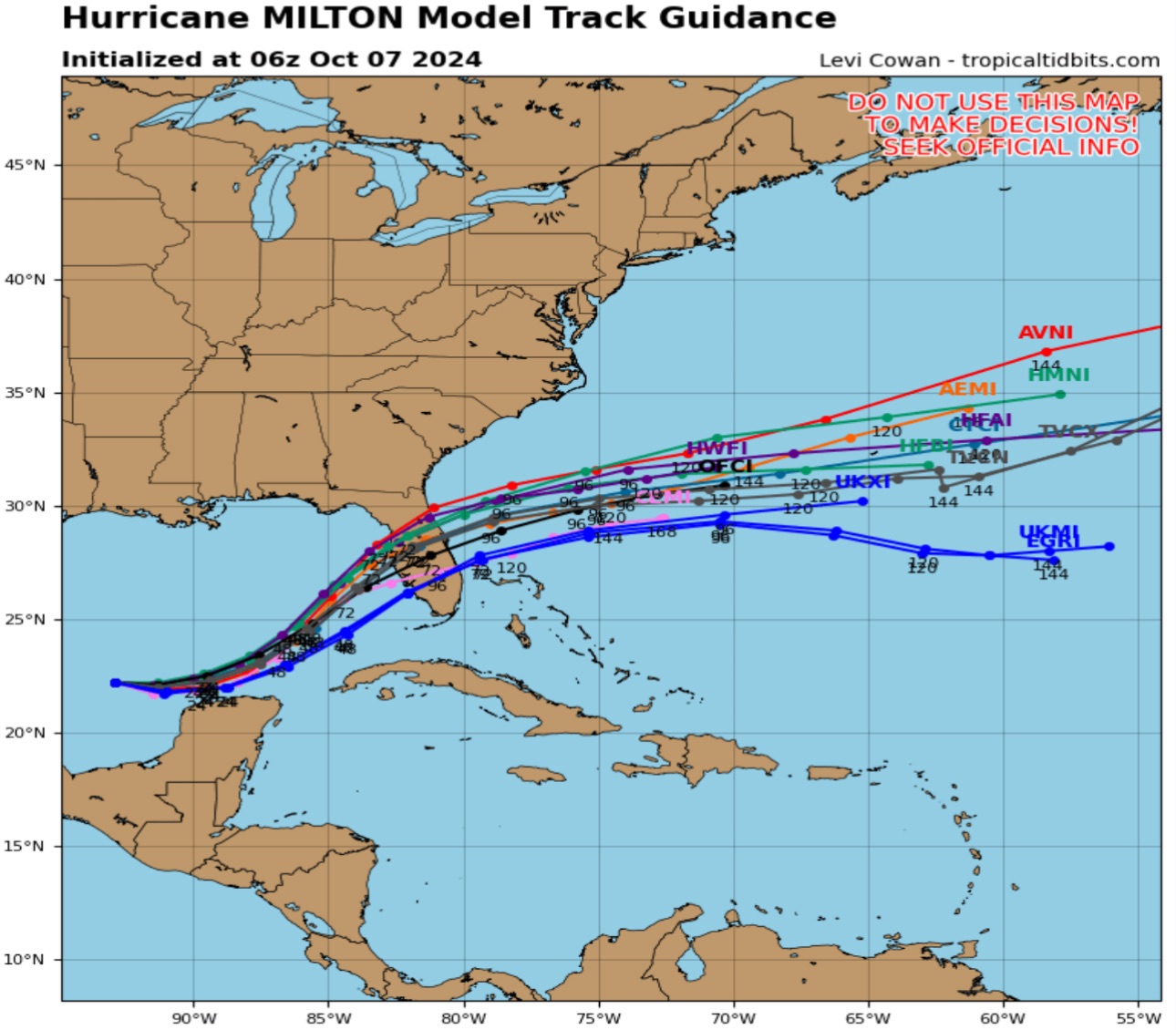
A key thing that I must stress when compared to Helene was while that storm’s track was basically locked in because of atmospheric conditions that is NOT the case with Milton. The storm continues to strengthen while moving slowly and erratically for a tropical system (with wobbles to the south in addition to its unusual due east movement- Tropical Systems in the Gulf almost never move Southeast)
Once again I would urge readers to put their faith in local TV meteorologists in the Tampa/St Pete, Orlando, Fort Myers and Miami/Fort Lauderdale markets. They know Tropical Weather better than most national TV weather personalities and have enhanced predictive tools that many stations in Florida invested in.
In terms of landfall, my hunch is this storm could end up just about anywhere in the peninsula. While the center of the projected track tells us a landfall between Sarasota and St Petersburg, I believe it could be as far south as Fort Myers or as far north as Cedar Key. Unlike Helene, the range is wide and also unlike that storm it will cut right across the peninsula. However, the wind field won’t be as wide as Helene so areas impacted by Helene in southeast Florida may dodge this storm completely if the track is further north. Likewise, areas of Northeast Florida that were ravaged by Helene might escape totally if the track is further south.
Here is the latest look at the storm models.